Sailing the Fram Strait
Every year, our ships sail in the wake of great explorers across the icy waters of the Fram Strait.
3 mins read
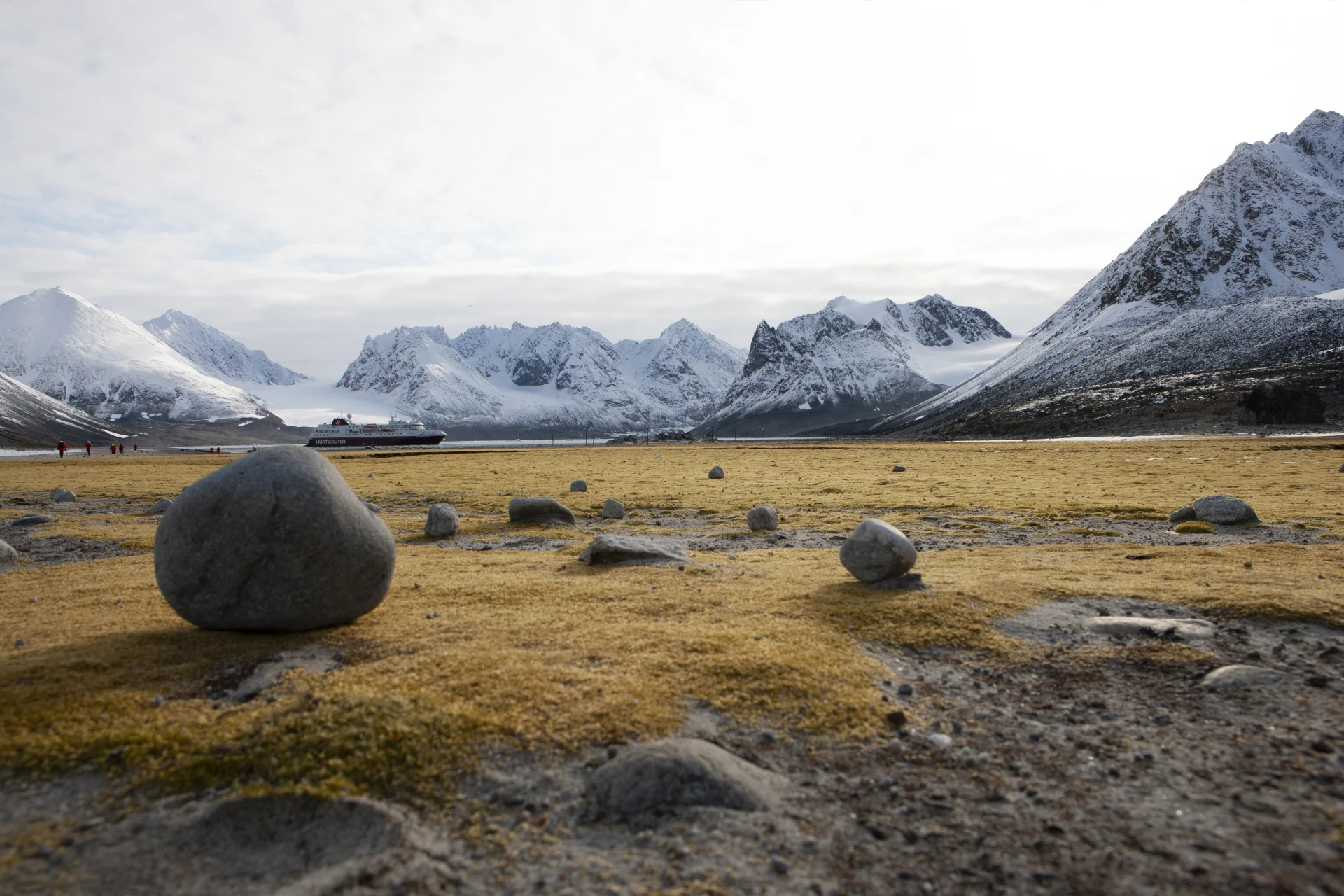
The Fram Strait lies between eastern Greenland and the island of Spitsbergen in the Svalbard Archipelago. The Greenland and Norwegian Seas lie to the south of the strait, with the Arctic Ocean to the north. It’s the only deep strait connecting the Arctic Ocean to other oceans, 300km wide and around 2,500m at its deepest point, but significantly shallower at its edges where it sits on the continental shelf. It’s also the northernmost ocean area that enjoys ice-free conditions, making it an important channel for sea traffic in the Arctic region.
In fact, the Fram Strait was named after the Norwegian explorer Fridtjof Nansen’s expedition ship Fram, which means ‘forward’. On his famed North Pole expedition (1893-96), Nansen froze the Fram into the Siberian part of the Arctic sea ice, based on the hypothesis that it would drift in the pack ice across the Arctic Ocean to the North Pole by harnessing the natural east–west current. In the event, this never materialised and the Fram drifted in sea ice for two years before finally exiting through the channel of open water by north Spitsbergen, which we now know as the Fram Strait.
Interestingly, the name ‘Fram Strait’ was coined by Russian oceanographers as late as the 1970s, and while it can be found on navigation charts and maps, it is not actually an officially recognised name.
To the west of the Fram Strait, the often ice-clogged waters flow south from the Arctic Ocean, keeping east Greenland much colder and icier than similar latitudes in west Greenland. To the east of the Fram Strait, warmer Atlantic currents flow northwards, making the west coast of Spitsbergen relatively mild and ice-free, given the high latitudes.
Our ice-strengthened ships are capable of navigating the Fram Strait along the east coast of Greenland and Spitsbergen as late as August, when typically only icebreakers can pass. Our expedition ships take you deep into the High Arctic, well above the 80th parallel and as close as 600 nautical miles from the Geographical North Pole. In the barren and spectacular scenery of the Arctic tundra, you can experience expedition landings and activities in the largest arctic wilderness in Europe.
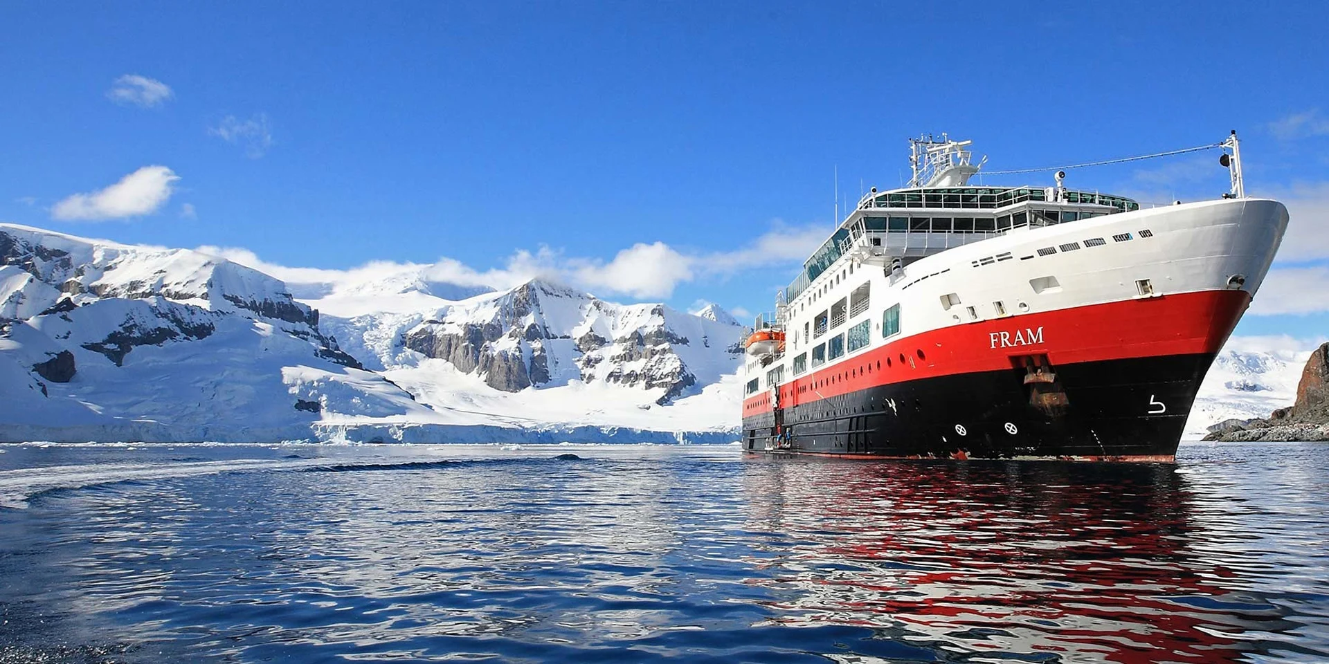
About our ship, MS Fram
Hurtigruten’s MS Fram, inspired by and named after the original, is a purpose-built polar expedition vessel, using the most advanced technology, such as a higher ice-class, chart drawing tools, ship depth sounding database, extractable forward sounding sonar, iceberg search lights, autonomous tracking system, oversized oil retention system for self-sufficiency, complete with a full ‘expedition tools-deck’.
Text by Hurtigruten expedition team members, Friederike Bronny - Geographer and John Chardine - Ornithologist.